Rains are failing, crops are suffering, and many people blame El Niño. Yet few understand what it actually is or how it works. Here is a plain, simple breakdown of how this global climate cycle functions and why it matters so much to our weather.
Start with the Pacific
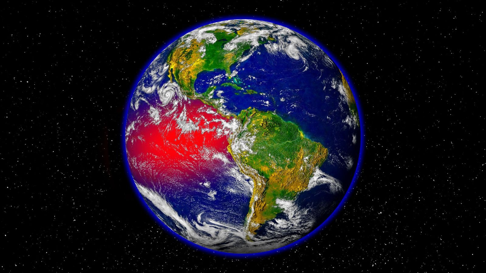
The Pacific is Earth’s largest ocean. It covers about a third of the planet’s surface, more than all the landmasses combined. Because it spans the equator, it absorbs a massive amount of solar energy, acting like Earth’s giant hot-water heater. When warm water shifts across this vast ocean, global weather shifts with it.
The normal pattern
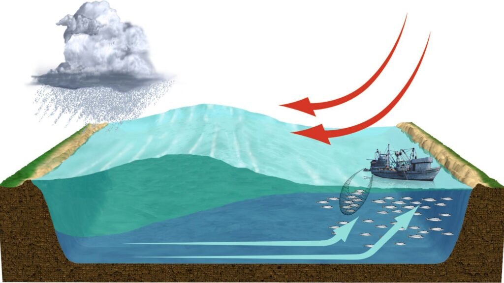
Near the equator, winds blow steadily from east to west. They are called trade winds because sailors once relied on them. These winds push warm surface water toward Indonesia and Australia, while cold water rises from the deep near Peru. Warm water means more evaporation, and more evaporation means more rain clouds.
- The West (Indonesia & Australia): The trade winds push warm surface water toward Asia and Australia. As this warm water accumulates, it causes heavy evaporation, forming rain clouds and bringing abundant rainfall.
- The East (Peru & South America): As warm water is pushed west, deep, cold, nutrient-rich water rises from below to replace it off the coast of South America. This process is called upwelling. The cold water supports rich marine life and helps keep the local coastal climate relatively dry.
What is El Niño?
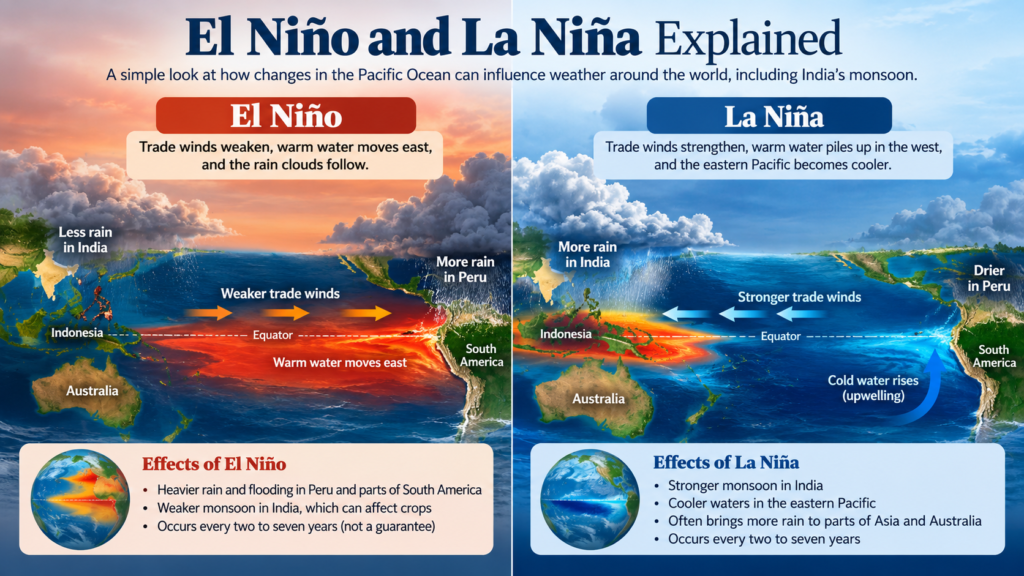
Imagine blowing gently on a bowl of water instead of blowing hard. The water stops piling up on one side and begins to slosh back. That is El Niño: the trade winds weaken, allowing the warm water to move east toward South America. The rain clouds follow it.
Peru may experience heavy rain and flooding, while India loses some of the usual support for its monsoon. The air above India tends to sink and become drier, so the monsoon, the summer rain that farms depend on, often weakens.
Scientists identify an El Niño when the central and eastern tropical Pacific becomes at least about 0.5°C warmer than average for several months. It typically occurs every two to seven years.
It is not a guarantee, though. In 1997, India received normal rainfall despite a strong El Niño, partly because the Indian Ocean was unusually warm.
What is La Niña?
La Niña is the opposite. The trade winds become stronger, warm water piles up near Indonesia, and the eastern Pacific becomes cooler. India usually gets a stronger monsoon during La Niña years.
Where do the names come from?
Peruvian fishermen noticed unusually warm coastal waters around Christmas, when their catch often shrank. They called the phenomenon El Niño, Spanish for “the boy,” referring to the Christ child. Its cooler counterpart was later called La Niña, meaning “the girl.”
The big picture
In the early 20th century, British scientist Sir Gilbert Walker noticed that air pressure between the eastern and western Pacific rose and fell like a seesaw: when pressure was high in the east, it was low in the west, and vice versa. He named this atmospheric shift the Southern Oscillation.
Eventually, meteorologists realized that the ocean temperature changes of El Niño and La Niña and the atmospheric pressure changes of the Southern Oscillation were part of one interconnected system. Today, scientists call the entire cycle ENSO (El Niño-Southern Oscillation).
Put simply, El Niño and La Niña are the Pacific’s two moods. They can steer rainfall and weather patterns across the globe, including India’s monsoon.