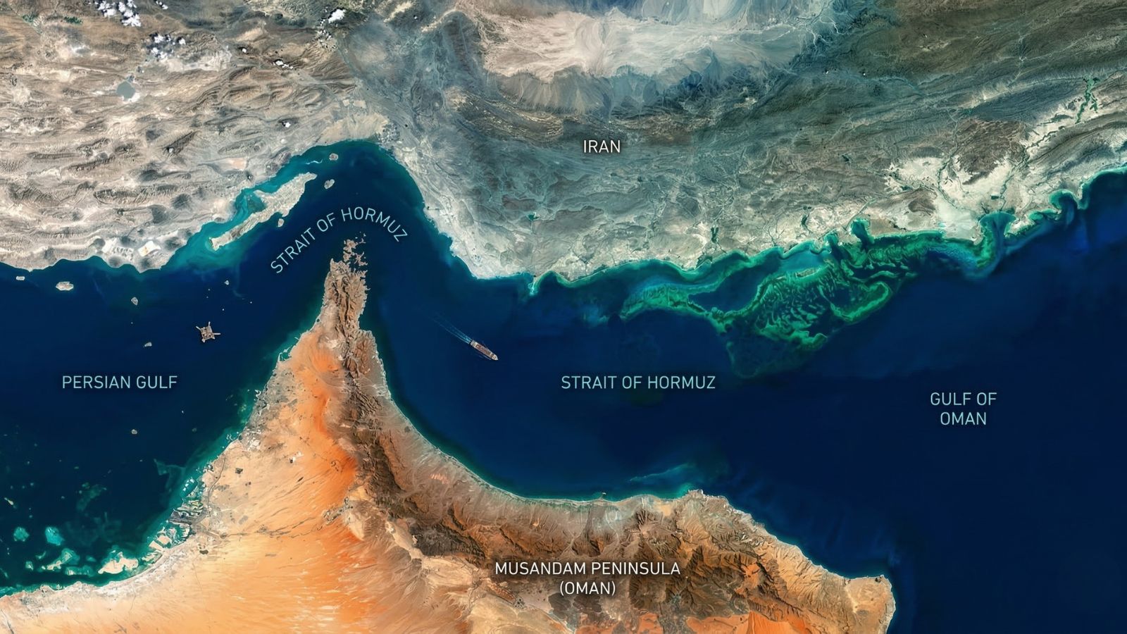
The Strait of Hormuz is a vital maritime corridor separating Iran to the north from Oman and the UAE to the south. It serves as the sole nautical link between the Persian Gulf and the open waters of the Gulf of Oman and the Arabian Sea. Unlike man-made canals or broad gulfs, this naturally formed “strait” serves as a narrow, high-stakes funnel for the world’s energy supply.
Precise Location and Geography
The waterway sits between Iran’s rugged southern coast and Oman’s Musandam Peninsula. At its narrowest point, the passage is only 33 km (21 miles) wide. Within this stretch, the actual shipping lanes—governed by international transit rules—are a mere 3 km (2 miles) wide in each direction, separated by a 2-mile buffer zone. This extreme compression makes it one of the most difficult maritime environments to navigate and defend.
Historical and Etymological Origins
Most scholars trace “Hormuz” to the Middle Persian Hormoz, derived from Ahura Mazda, the supreme deity of Zoroastrianism. Others suggest a more terrestrial origin from Hur-mogh, meaning “place of dates.” Another view links it to the ancient Hormuz Kingdom, a prosperous trading power (10th–17th century) based on Hormuz Island, later eclipsed by Portuguese expansion in 1515.
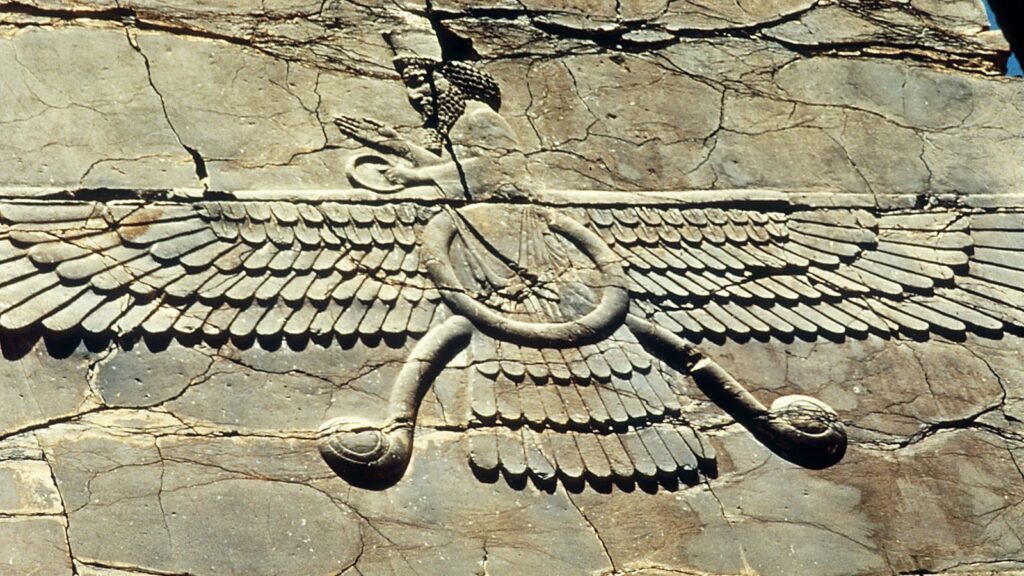
Ahura Mazda
Global Economic Importance
Often cited as the world’s most critical oil chokepoint, the strait handles approximately 20 million barrels of petroleum liquids daily—roughly 20% of global consumption. It is also the primary exit for massive Liquefied Natural Gas (LNG) flows from Qatar. While bypasses like Saudi Arabia’s East-West Pipeline (currently pushed to its 7 million bpd limit) and the UAE’s Abu Dhabi system exist, they lack the capacity to fully replace the strait’s volume.
Iran’s Strategic Leverage
For the global economy, the Strait of Hormuz is a high-stakes lever where geography and energy security collide.
Iran exerts a “commanding” presence over the waterway due to its extensive northern coastline and possession of strategic islands like Qeshm, Hormuz, and Abu Musa. These landmasses allow Iran to oversee the deepest shipping channels, which often fall within its territorial waters. By employing asymmetric naval tactics (such as utilizing fast-attack boats, sea mines, and coastal missile batteries), Iran can effectively monitor or disrupt traffic, using the geography as a powerful geopolitical lever.
In the current climate as of March 2026, where regional tensions have recently halted nearly 90% of tanker traffic, the Strait of Hormuz remains the single most sensitive barometer for global energy security and oil market stability.
Definitions Worth Knowing
Here are some simple terms that often get confused:
- Strait: A narrow natural water passage that connects two larger bodies of water.
Example: Strait of Hormuz - Gulf: A large part of the sea that cuts deep into the land, usually with a narrow opening.
Example: Persian Gulf - Bay: Similar to a gulf, but with wider opening (mouth) than a gulf and a more inward-curving coastline.
Example: Bay of Bengal - Sea: A large body of saltwater, smaller than an ocean and often partly enclosed by land.
Example: Arabian Sea - Ocean: The largest continuous body of saltwater covering most of the Earth.
Example: Indian Ocean - Canal: A man-made waterway built to connect two water bodies or aid transport.
Example: Suez Canal - Channel: A wider term for a navigable water route, which may be natural or man-made.
Example: English Channel - Harbor (or Port): A sheltered area along the coast where ships can dock safely.